
Product details
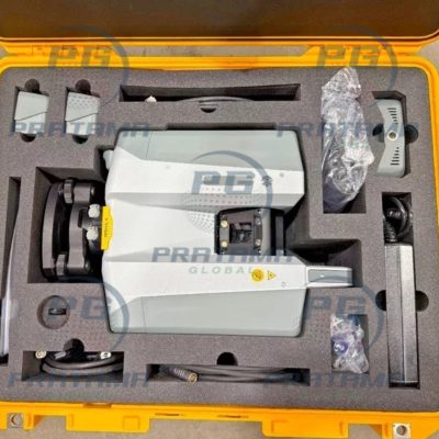
Buy GREENVALLEY LiGrip H300 + LiFuser BP Professional SLAM LiDAR Scanning System for High-Precision 3D Mapping
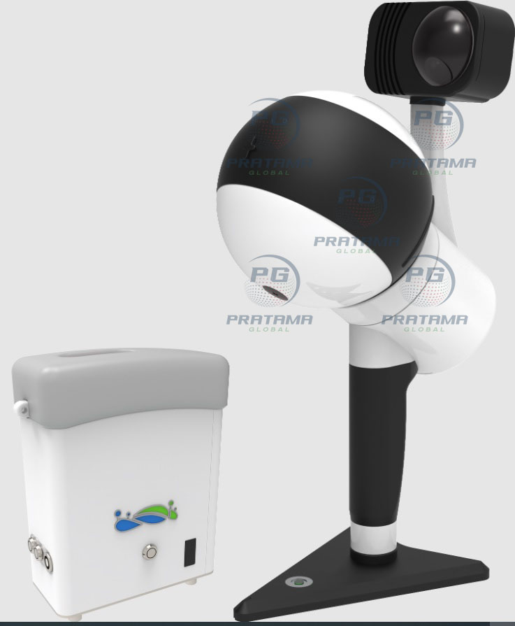
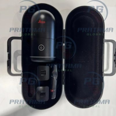
The GREENVALLEY LiGrip H300 + LiFuser BP is a powerful and flexible mobile LiDAR scanning solution designed for fast, accurate, and efficient 3D mapping in indoor and outdoor environments. Equipped with the advanced XT32M2X LiDAR sensor, the LiGrip H300 delivers long-range scanning, high-density point clouds, and professional-grade SLAM performance for surveying, engineering, construction, mining, and infrastructure projects.
Built for mobility and precision, this lightweight handheld system supports multiple mapping methods and platform configurations to meet demanding field applications.
Why Choose LiGrip H300 + LiFuser BP?
Long-Range LiDAR Scanning – Capture detailed point cloud data up to 300 meters with high scanning efficiency.
High-Speed Performance – Generate dense 3D data with up to 640,000 points per second for accurate reality capture.
Flexible Mapping Modes – Supports SLAM, RTK-SLAM, and PPK-SLAM for reliable positioning in both GNSS-covered and GNSS-denied environments.
Multi-Platform Deployment – Use as a handheld, backpack, vehicle-mounted, or drone-mounted system for maximum versatility.
Professional Accuracy – Achieve relative accuracy up to 1 cm and absolute accuracy within 5 cm.
Portable & Lightweight – Compact ergonomic design allows easy transport and efficient field operation.
Real-Time Processing – Supports real-time data processing for faster project workflows and immediate quality assessment.
Key Features
XT32M2X LiDAR Sensor
Scanning Range: Up to 300 m
Scan Rate: 640,000 pts/s
Accuracy: Up to 1 cm
Field of View: 280° × 360°
512 GB Storage Capacity
IP54 Dust & Water Resistance
Battery Life: Up to 3 Hours
USB & Ethernet Connectivity
Real-Time SLAM Processing
Integrated Panoramic Camera
The system includes the INSTA ONE RS 1-inch panoramic camera for high-resolution image capture and immersive visual documentation.
Photo Resolution: 6528 × 3264
Video Resolution: 6144 × 3072
1-Inch CMOS Sensor
Applications
3D Mobile Mapping
Surveying & Engineering
Construction Documentation
Mining & Quarry Mapping
Infrastructure Inspection
BIM & Digital Twin Creation
Forestry & Environmental Surveys
Utility & Asset Management
Engineered for professional operation, the LiGrip H300 features secure mounting, stable performance, and Class-compliant LiDAR technology for safe and reliable field use. Its rugged IP54-rated design supports demanding indoor and outdoor surveying environments.
Upgrade your mapping workflow with the GREENVALLEY LiGrip H300 + LiFuser BP—high-speed SLAM LiDAR scanning with professional accuracy, portability, and multi-platform flexibility.
There are no reviews yet.