
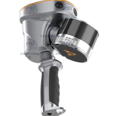
CHCNAV RS10 SLAM 3D LiDAR Scanner
Rated 0 out of 5
0 Reviews
Achieve up to 2 cm absolute accuracy with powerful GNSS RTK + SLAM fusion. Capture dense, georeferenced point clouds instantly—no loop closure required—saving time and simplifying workflows in challenging environments like urban areas or underground spaces.
Achieve up to 2 cm absolute accuracy with powerful GNSS RTK + SLAM fusion. Capture dense, georeferenced point clouds instantly—no loop closure required—saving time and simplifying workflows in challenging environments like urban areas or underground spaces.
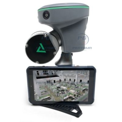
GeoCue TrueView GO132S Handheld LiDAR Scanner
Rated 0 out of 5
0 Reviews
The GeoCue TrueView GO132S Professional Handheld LiDAR Scanner delivers fast, accurate, and efficient 3D reality capture for surveying, BIM, construction, and infrastructure inspection applications.
The GeoCue TrueView GO132S Professional Handheld LiDAR Scanner delivers fast, accurate, and efficient 3D reality capture for surveying, BIM, construction, and infrastructure inspection applications.
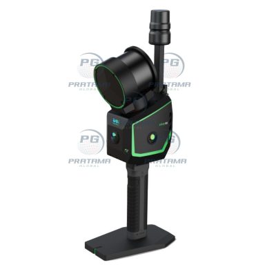
GREENVALLEY LiGrip O2 SLAM 3D LiDAR Scanner
Rated 0 out of 5
0 Reviews
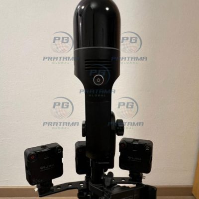
The GREENVALLEY LiGrip O2 SLAM 3D LiDAR Scanner with GNSS RTK is a professional mobile mapping system designed for fast and accurate 3D data capture in indoor and outdoor environments. Featuring a 120-meter scanning range, 32-channel LiDAR sensor, and integrated GNSS RTK positioning, the LiGrip O2 delivers high-precision point cloud generation for surveying, BIM, construction, forestry, mining, and digital twin applications. Its lightweight handheld design ensures efficient SLAM-based mapping with exceptional mobility and productivity.
The GREENVALLEY LiGrip O2 SLAM 3D LiDAR Scanner with GNSS RTK is a professional mobile mapping system designed for fast and accurate 3D data capture in indoor and outdoor environments. Featuring a 120-meter scanning range, 32-channel LiDAR sensor, and integrated GNSS RTK positioning, the LiGrip O2 delivers high-precision point cloud generation for surveying, BIM, construction, forestry, mining, and digital twin applications. Its lightweight handheld design ensures efficient SLAM-based mapping with exceptional mobility and productivity.
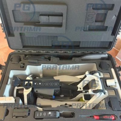
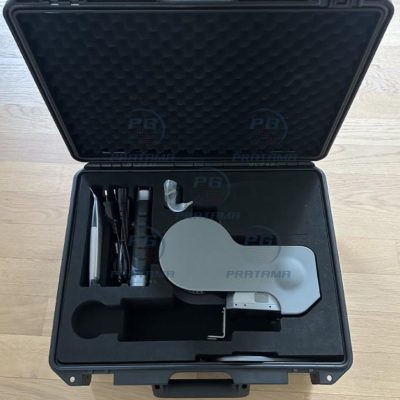
NavVis VLX3 3D Laser Scanner Complete Kit
Rated 0 out of 5
0 Reviews
The NavVis VLX3 3D Laser Scanner Complete Kit is a cutting-edge mobile mapping system designed for fast, accurate reality capture. Ready to deploy, it enables seamless LiDAR scanning in complex indoor and outdoor environments. Ideal for surveying, construction, and digital twin creation, the VLX3 delivers high-quality data with exceptional efficiency and ease of use.
The NavVis VLX3 3D Laser Scanner Complete Kit is a cutting-edge mobile mapping system designed for fast, accurate reality capture. Ready to deploy, it enables seamless LiDAR scanning in complex indoor and outdoor environments. Ideal for surveying, construction, and digital twin creation, the VLX3 delivers high-quality data with exceptional efficiency and ease of use.
Used Leica BLK2GO Handheld Laser Scanner
Rated 0 out of 5
0 Reviews
Capture accurate 3D spatial data faster with the Used Leica BLK2GO Handheld Mobile Laser Scanner (2022). Contact us today for pricing, availability, and worldwide shipping support.
Capture accurate 3D spatial data faster with the Used Leica BLK2GO Handheld Mobile Laser Scanner (2022). Contact us today for pricing, availability, and worldwide shipping support.
Used XGRIDS L2 Pro 32 Channels LiDAR Scanner
Rated 0 out of 5
0 Reviews
Upgrade your surveying and reality capture capabilities with the Used XGRIDS L2 Pro 32 Channels / 300m LiDAR Scanner (2024). Contact us today for pricing, availability, and worldwide delivery options.
Upgrade your surveying and reality capture capabilities with the Used XGRIDS L2 Pro 32 Channels / 300m LiDAR Scanner (2024). Contact us today for pricing, availability, and worldwide delivery options.