
Product details
CHCNAV RS10 SLAM 3D LiDAR Scanner with GNSS RTK – 300m Range 32-Channel Mobile Mapping System
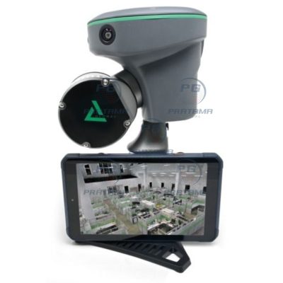
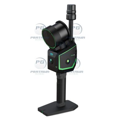
Map complex environments with speed and precision using the CHCNAV RS10—an advanced all-in-one SLAM LiDAR scanner with integrated GNSS RTK. Designed for surveying, BIM, construction, and infrastructure inspection, it delivers real-time, high-accuracy 3D data both indoors and outdoors.
Why Choose CHCNAV RS10?
Achieve up to 2 cm absolute accuracy with powerful GNSS RTK + SLAM fusion. Capture dense, georeferenced point clouds instantly—no loop closure required—saving time and simplifying workflows in challenging environments like urban areas or underground spaces.
Key Features:
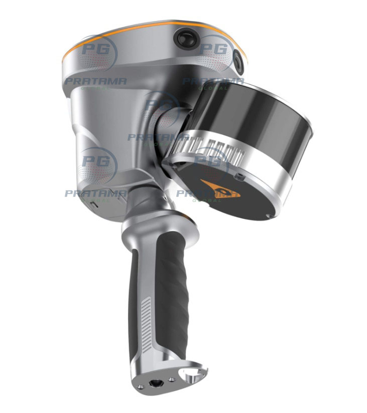
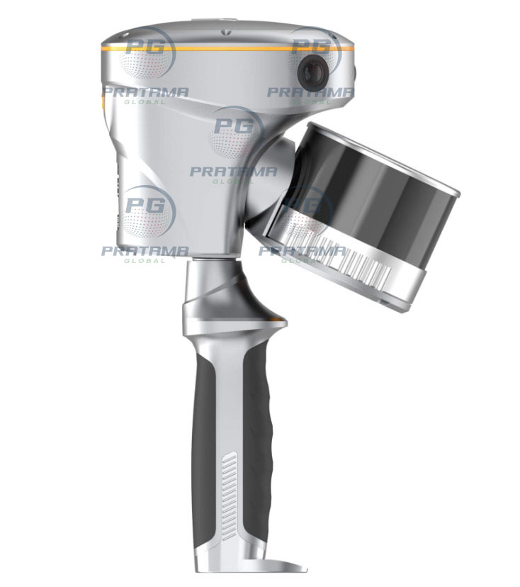
32-channel LiDAR with up to 300m range
High-speed scanning up to 1.92 million points/sec
Real-time georeferenced point cloud generation
GNSS RTK + SLAM + Visual fusion for maximum accuracy
Loop-free data acquisition for faster fieldwork
3 HD cameras for colorized 3D models
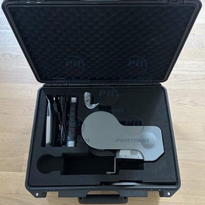
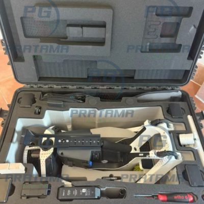
512GB storage with 4G, Wi-Fi, and Bluetooth connectivity
Lightweight (≈1.7 kg) and IP64-rated rugged design
Hot-swappable battery (≈60 min per battery)
Seamless indoor/outdoor mapping in one workflow
Built for Professional Applications
Ideal for surveying, construction, forestry, mining, powerline inspection, and underground mapping. Covers up to 13,000 m² in real time with instant feedback for complete data capture.
Technical Highlights:
Accuracy: <2 cm absolute, <1 cm relative
Field of View: 360° × 270°
Laser: Class 1 eye-safe, 905 nm
Storage: 512GB
Operating Temp: -20°C to +50°C
Class 1 eye-safe laser. Operate in accordance with local regulations and site safety standards. Ensure proper training, avoid restricted areas, and respect privacy during data capture.
Upgrade your 3D mapping workflow with the CHCNAV RS10—fast, accurate, and built for demanding environments.
There are no reviews yet.